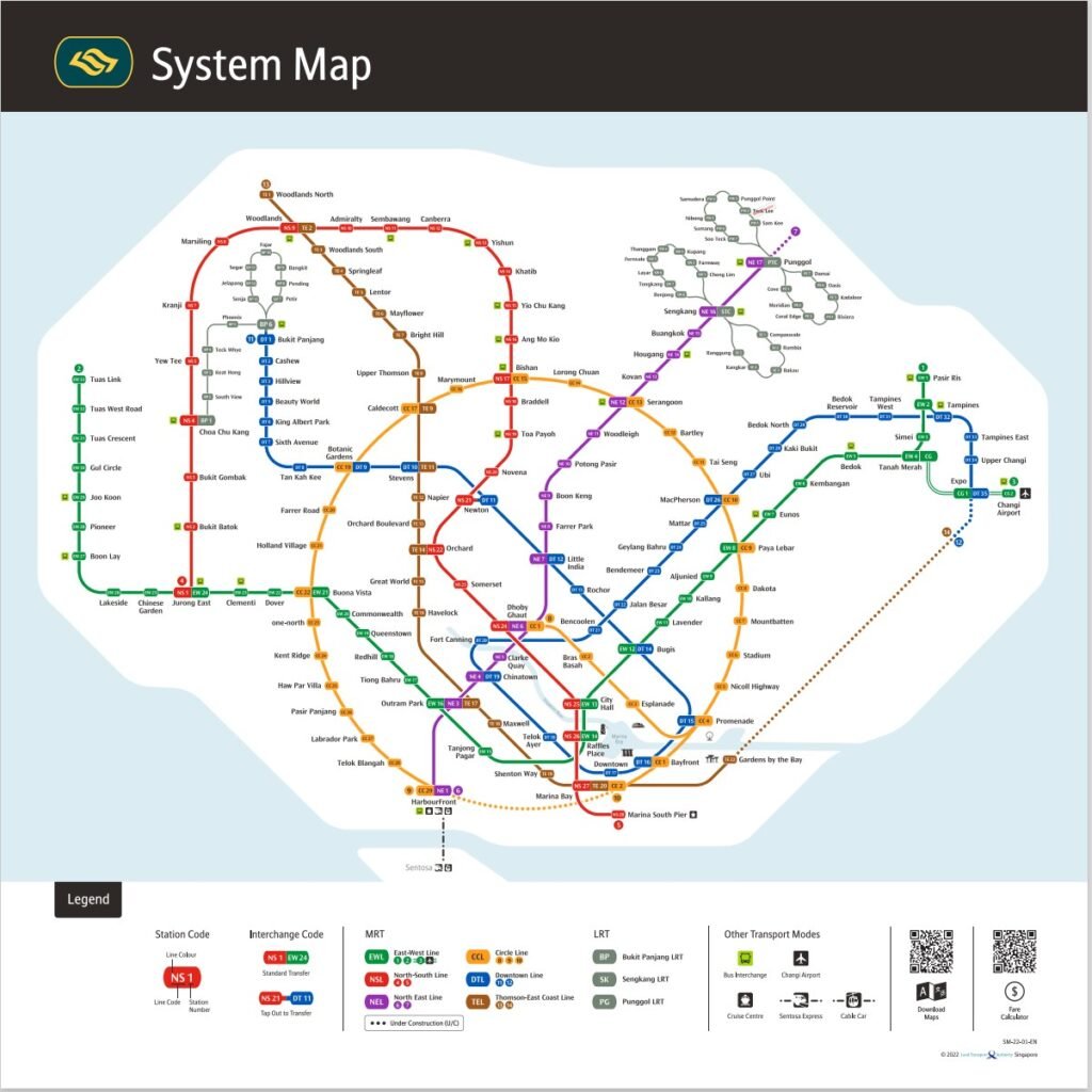
SINGAPORE MAP - REGION AND DISTRICT Core Central Region DistrictGeneral Location 1Raffles Place, Cecil, Marina, People's Park 2Anson, Tanjong Pagar 6High Street, Beach Road (part) 9Orchard, Cairnhill, River Valley 10Ardmore, Bukit Timah, Holland Road, Tanglin 11Watten Estate, Novena, Thomson Rest of Central Region DistrictGeneral Location 3Queenstown, Tiong Bahru 4Telok Blangah, Harbourfront 5Pasir Panjang, Hong Leong Garden, Clementi New Town 7Middle Road, Golden Mile 8Little India 12Balestier, Toa Payoh, Serangoon 13Macpherson, Braddell 14Geylang, Eunos 15Katong, Joo Chiat, Amber Road 20Bishan, Ang Mo Kio Outside of Central Region DistrictGeneral Location 16Bedok, Upper East Coast, Eastwood, Kew Drive 17Loyang, Changi 18Tampines, Pasir Ris 19Serangoon Garden, Hougang, Ponggol 21Upper Bukit Timah, Clementi Park, Ulu Pandan 22Jurong 23Hillview, Dairy Farm, Bukit Panjang, Choa Chu Kang 24Lim Chu Kang, Tengah 25Kranji, Woodgrove 26Upper Thomson, Springleaf 27Yishun, Sembawang 28Seletar SINGAPORE MAP - MRT SYSTEM